
A country also takes shape through its roads. Highways act like major arteries running across the territory, connecting distant places and enabling the movement of people, goods, and ideas.
Building these critical infrastructures requires complex design choices, able to engage with diverse landscapes, challenging environmental conditions, and increasingly demanding safety standards. It is within this balance between functionality, engineering, and long-term vision that highway infrastructure becomes a fundamental tool for national cohesion and development.
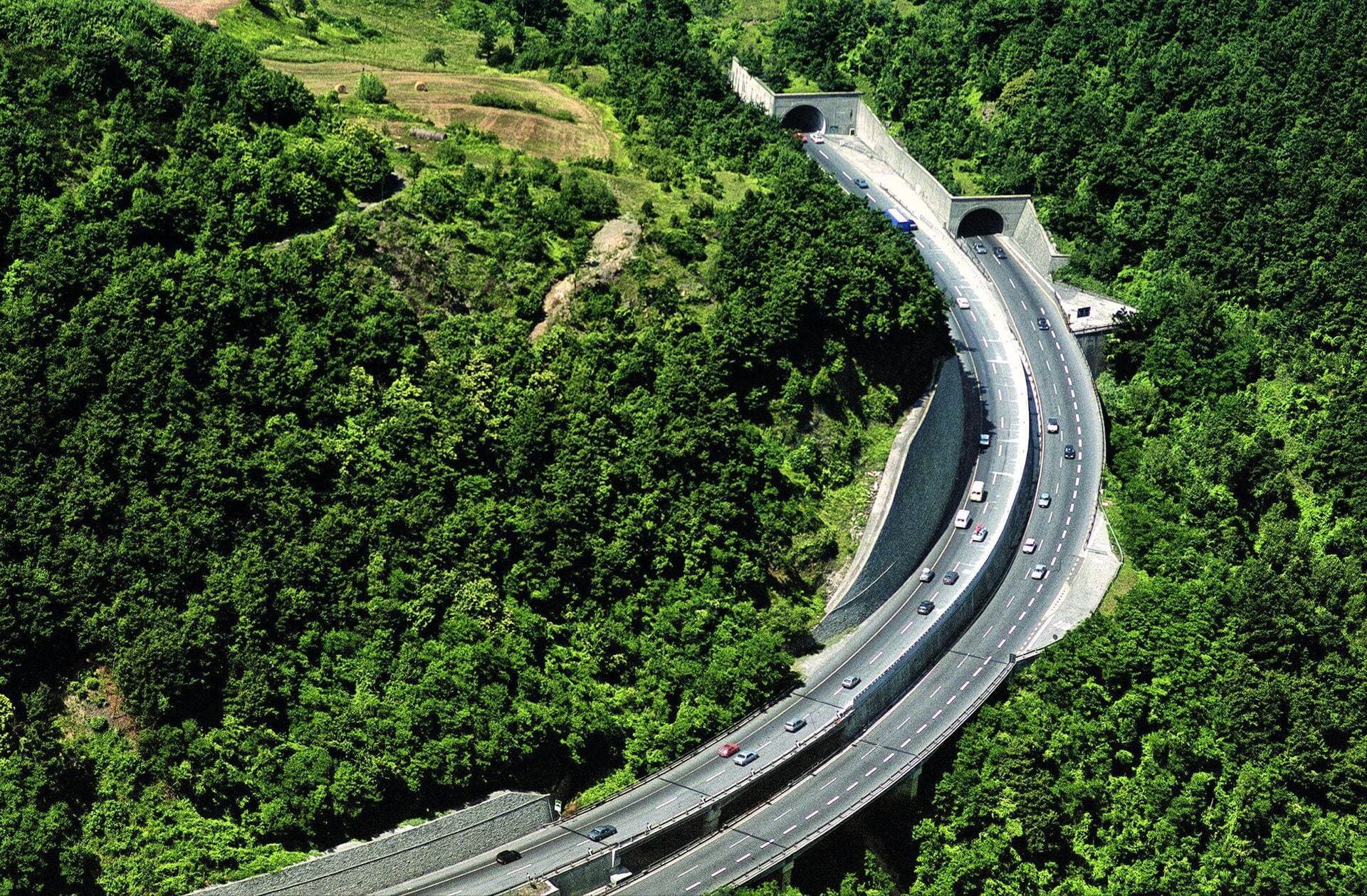
1 – Autostrada del Sole (Italy)
The Autostrada del Sole (A1), often described as the “backbone” of Italy, is a remarkable example of an infrastructure development project that transformed national mobility and supported the country’s modernization.
Stretching for around 760 kilometers from Milan to Naples via Bologna, Florence, and Rome, the Italian highway dramatically reduced travel times between the North and the South and still represents the main north–south axis of the Italian roads network
Infrastructure construction began in 1956 and was completed in just eight years, using engineering approaches that were highly advanced for their time across a geologically complex landscape. The project included 113 viaducts, 572 overpasses, and 35 tunnels.
Many of the companies that later became part of the Webuild Group contributed to this monumental undertaking, overcoming major technical and logistical challenges to connect the entire country in a safe and efficient way.
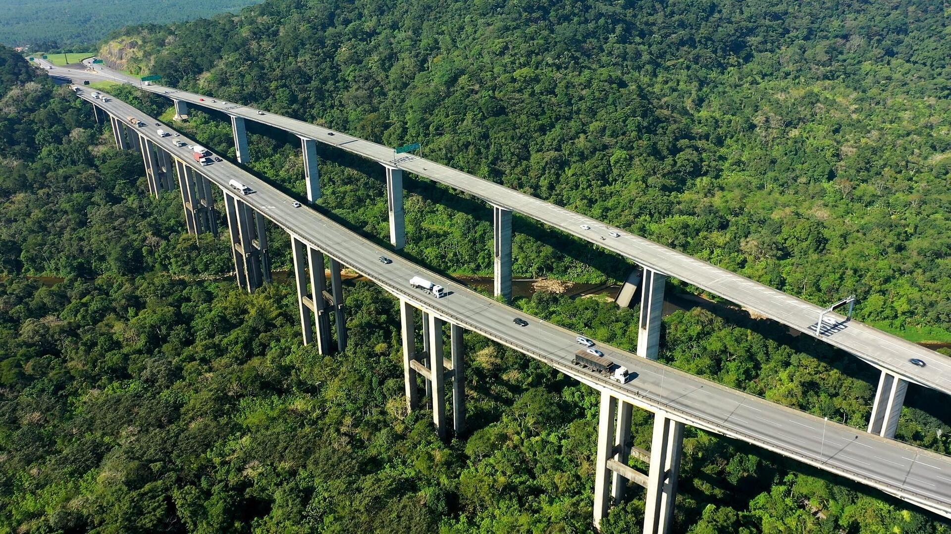
2 – The Anchieta–Imigrantes Highway System (Brazil)
The Anchieta–Imigrantes highway system is one of the most emblematic examples of how major critical infrastructure can reshape a country’s flows and mobility solutions.
Linking the São Paulo metropolitan area with the Port of Santos, one of South America’s leading logistics hubs, this infrastructural network crosses dense urban areas and highly complex mountainous terrain, made accessible through an articulated system of viaducts and tunnels.
Webuild also contributed to the construction of the Rodovia dos Imigrantes, deploying advanced engineering solutions to enhance capacity, safety, and continuity along one of Brazil’s most strategic economic corridors.
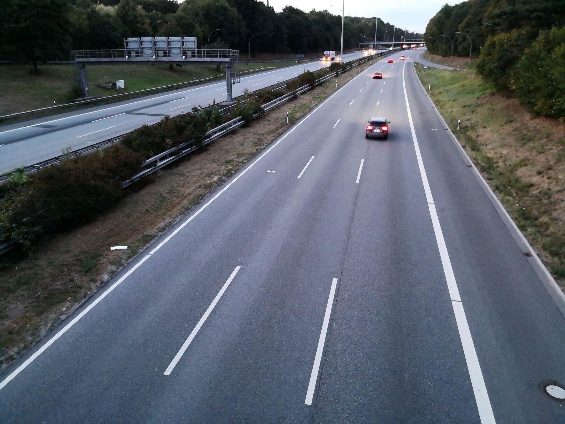
3 – Bundesautobahn 7 (Germany)
Another major example of road infrastructure is the Bundesautobahn 7 (also known as Autobahn 7 or A7), the longest German highway and one of Europe’s main north–south corridors.
Extending for around 962 kilometers, the Bundesautobahn 7 connects the Danish border in the far north to the Austrian border in the south, crossing key regions such as Schleswig-Holstein, Hamburg, Hesse, and Bavaria, and serving as a fundamental axis for both international and national mobility.
4 – Autopista AP-7 (Spain)
Another major road artery in Europe is the AP-7 motorway, known as the Autopista del Mediterráneo, which runs along Spain’s coastline from the French border at La Jonquera to the Costa del Sol, connecting key cities such as Barcelona, Valencia, and Málaga across more than 1,000 kilometers.
Along its route, the AP-7 forms part of the European E15 corridor and is divided into two main sections, combining tolled and toll-free stretches that reflect different management models along the Mediterranean axis.

5 – Trans-Canada Highway (Canada)
The Trans-Canada Highway is one of the world’s largest and longest highway systems, with a main route stretching over 8,000 kilometers from Victoria on the Pacific coast to St. John’s on the Atlantic Ocean, crossing all ten Canadian provinces.
This transcontinental infrastructure connects key cities such as Vancouver, Calgary, Winnipeg, Ottawa, and Montréal, serving as a vital artery for domestic transport and the country’s economic development.
Opened in the 1960s and completed over the following decades, the Canadian highway is characterized by a mosaic of routes and construction standards, reflecting cooperation between federal and provincial authorities to create a truly unique coast-to-coast link.