


- Research & Markets predicts the market for digital twin-supported platforms in smart cities to reach $4.8 billion (€4.3 billion) in five years
- Digital twins used in construction could help commercial property and infrastructure owners reduce their energy consumption by up to 50%
- In West Harlem, New York City, the technology is being used to improve real-time traffic management
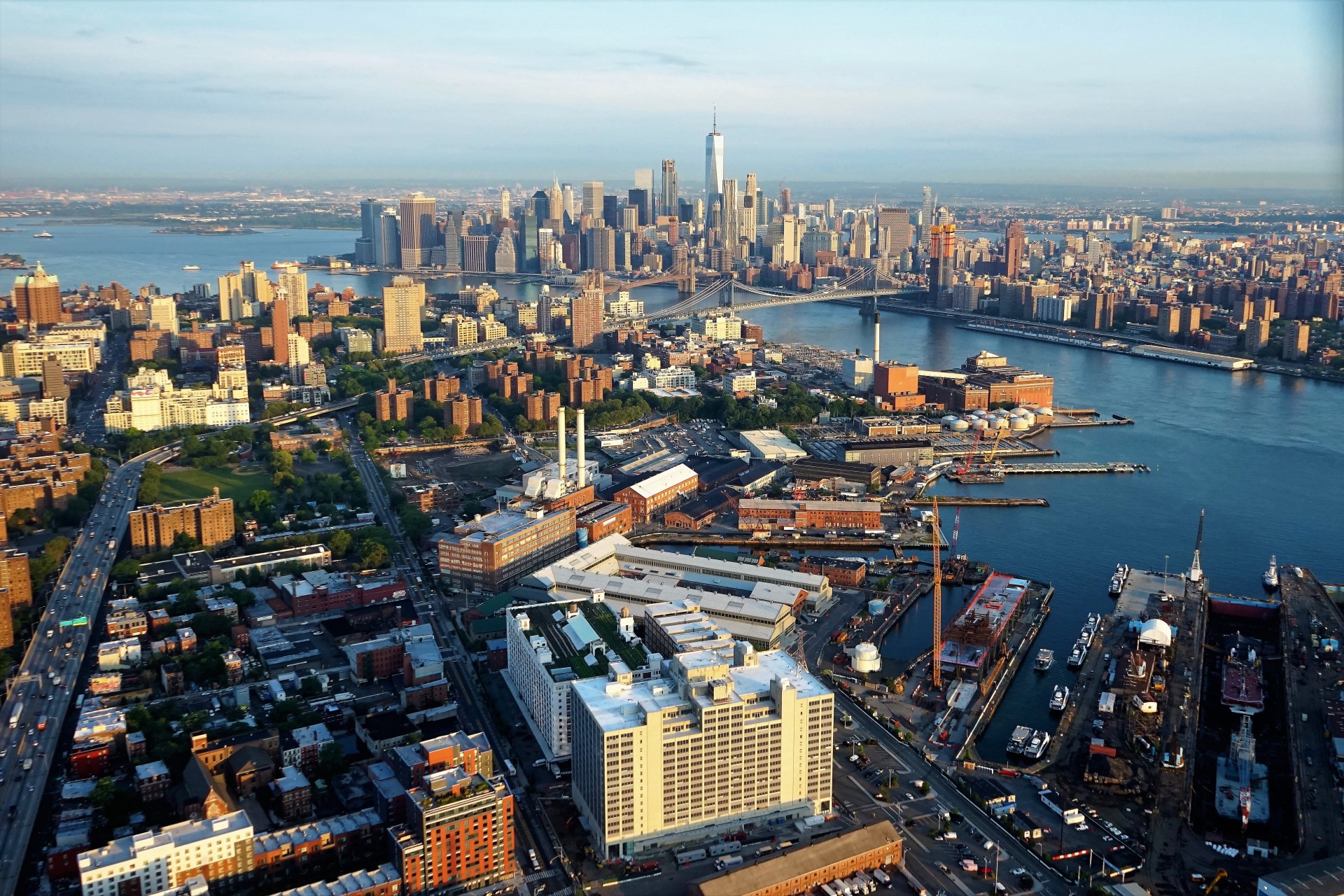
- In the Brooklyn Navy Yard, new digital twin technology will be adopted to reduce operating costs and carbon emissions of new buildings
There is a place in the United States where dreams continually become reality. The Kingdom of Mickey Mouse, Disney World in Orlando, Florida, continues to attract millions of people from every corner of the planet. Disney’s four Orlando theme parks — Magic Kingdom, Animal Kingdom, Epcot and Hollywood Studios — had nearly 58 million guests in 2018. An unstoppable flow of tourists and new residents that make the entire region around the city a mega-center with a fluctuating population that could reach 5.2 million people by 2030.
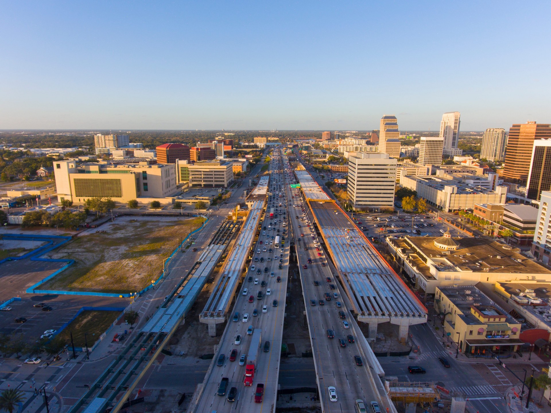
These numbers mean that dreams also can dictate reality. The city of Orlando is implementing solutions to create more sustainable, safe and energy-efficient living environments and rethink infrastructure in an increasingly smart and environmentally friendly way. In short, Orlando, like other U.S. cities, has decided to adopt the “digital twins” model to use real-time, essential data from its urban community to design infrastructure, direct business development and improve the public services network.
The Orlando Economic Partnership (OEP) agency, which unites the public and private sectors on its board, aims to turn the area into a smart region. It recently announced it is financing an investment in software and video-game developer Unity’s platform to map a 40-square-mile (around 103 sq km) metropolitan area that will include the Space Coast, amusement parks and the international airport. The announcement came on the heels of the annual Synapse conference, held an hour’s drive from Orlando, in Tampa, another high-growth Florida city also on the Digital Twin path. The Orlando project will be unveiled in October 2022 at Synapse Orlando.
Data sets collected from the region will allow businesses, local governments and nonprofits to visualize the impact of their plans on the region. By aggregating public and private sources of information, the “digital twin” will serve as a key resource for all decision-making centers, making the technology platform a vital piece of Orlando’s future. With digital transformation, local government agencies will be able to effectively analyse what can be done to improve residents’ lives, create economic opportunity and revitalise a community.
In South Florida, the state and federal governments have launched an extensive program to restore the Everglades and its pollution-threatened water system, including the Caloosahatchee (C-43) West Basin Storage Reservoir project. Now under construction by Lane (Webuild Group), this mega-reservoir will capture both excess stormwater runoff from the river basin and contaminated water discharged from Lake Okeechobee, regulating the flow of clean water where it is needed and when it is needed.
The project calls for construction of a reservoir and dam, 18 water control structures, discharge piping, a perimeter canal, a bridge, and about 18 million cubic yards of embankment.
Also in this case, a digital twin enabled Lane’s team to make the best decisions given the size and complexity of the project, because it could safely and effectively test the data collected on site. “Having an electronic repository of data, accessible via iPads and cell phones, easily usable and tagged with the correct information, is a huge advantage,” said Matt Blake, Lane’s BIM Director.
The big business of digital twins
Using the digital twin of a city or area at a very small scale (but large enough to understand its flows and habits) is sort of like looking down on an anthill and capturing its movements in a sort of time-lapse. Routes, obstacles, stops, even the weight of loads transported: every essential aspect will be recorded and analysed. These tools can help plan architectural and infrastructural solutions including housing, antennas for wireless networks, solar panels, transport and public services, and traffic regulation.
A survey of a sample of business managers by Research & Markets predicts the market for digital twin-supported platforms in smart to reach $4.8 billion (€4.3 billion) in five years. In addition, according to a report by consulting firm EY, digital twins used in construction and real estate could help commercial and infrastructure property owners reduce energy consumption by up to 50% and operating costs by 35%.
Several cities, including New York City, Las Vegas and Phoenix, have already commissioned or are in the process of adopting digital twins in their downtown areas to reduce carbon emissions. In the Big Apple, a team is processing responses from sensors placed on the streets of West Harlem as a test for improved real-time traffic management.
There’s more. By applying the new technologies to the New York Vision Zero traffic education program, the city government is trying to improve safety. Today, there are about 3,000 serious injuries and more than 200 deaths a year from traffic accidents, according to the city’s Vision Zero website. Being struck by a vehicle is the leading cause of injury death for children under 14, and the second leading cause for the elderly. The collection of data provided by sources and so-called IoT sensors – the Internet of Things, or the connection to the network of physical objects in everyday use, such as home lights, medical devices, and burglar alarm systems – onto a single dashboard will enable pedestrian traffic monitoring. In addition to smart camera detections, authorities will be able to process repetitive patterns of pedestrian accidents and, therefore, prevent them more effectively.
A system to reduce pollution and energy consumption
Another project, at the iconic Brooklyn Navy Yard site in New York City, will show how a digital twin will enable buildings of any size, type or age to significantly reduce operating costs and carbon emissions. The Yard has signed up for the “Clean Cities, Clean Future” initiative, launched by the company Cityzenith, creator of the Urban Digital Twin Platform. One of the founders of Cityzenith was the creator of what became Google Earth. The digital representation of buildings aims to transform the energy footprint of the Brooklyn Navy Yard.
Phoenix and Las Vegas have also signed up for the Cityzenith programme. The Arizona capital will assess the impact of rapid densification in the Downtown Phoenix Business Improvement District, 90 blocks of one of the most dynamic centers in the United States, to make it a model for sustainable growth. Las Vegas will focus the digital platform on its downtown, to analyze all its sensitive data, such as air quality, noise levels, humidity, temperature and other key environmental indicators.
From Boston, which will seek to improve the central Boston Commons park by studying the pattern of tree shadows, to Chattanooga in Tennessee, to Galveston in Texas, urban planners seem ready to take this new leap. From paper maps to topographic surveys, from aerial photogrammetry to 3D computer representations, digital technology will allow planners to redesign cities in 4D, adding an indispensable resource to improve the lives of people and the environment: time.