
 Lake Natoma, California, USA
 LOS ANGELES, Feb 2nd, 2019: Low angle shot of a man with umbrella walking across the stars on the wet and shiny pavement on Hollywood Walk of Fame in front of the Chinese Theatre, during a rainstorm.
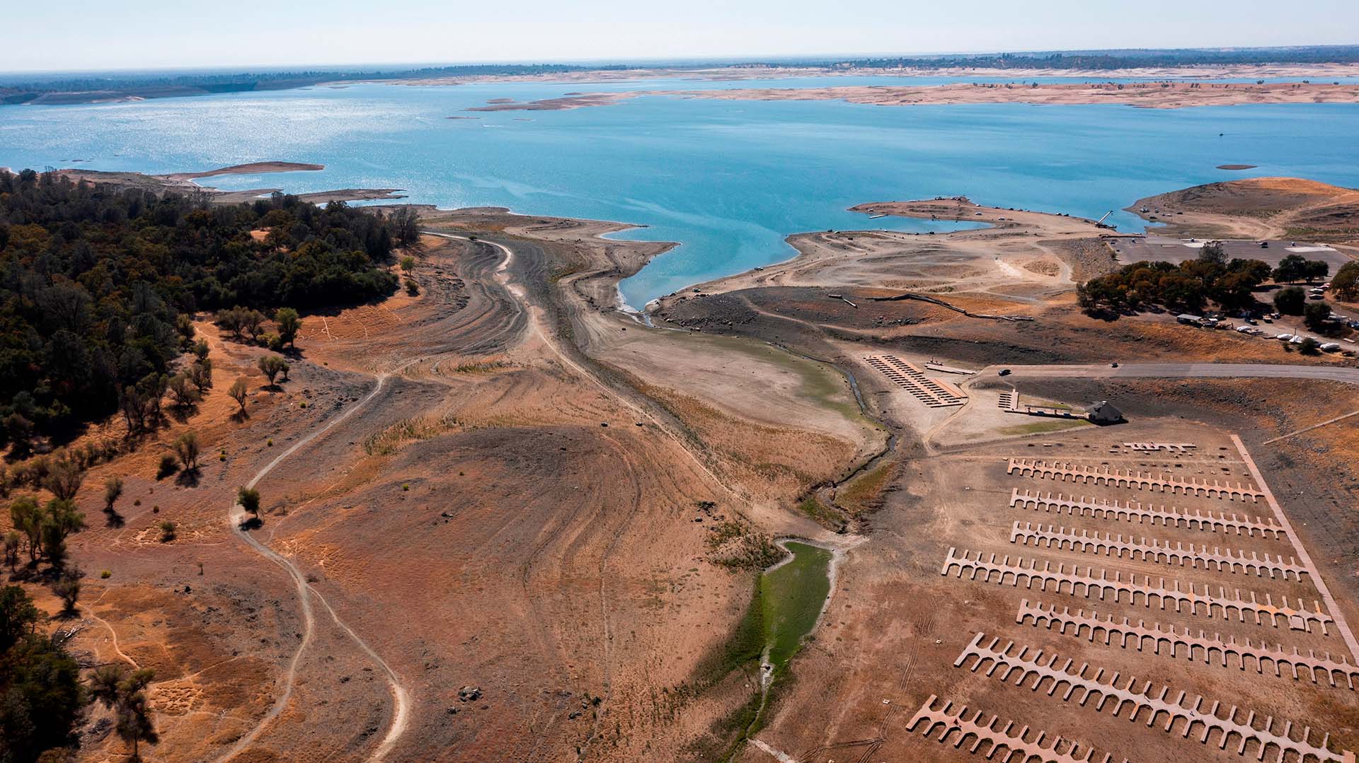 Aerial view of the severe drought conditions of Folsom Lake, a reservoir in Folsom, California, USA.
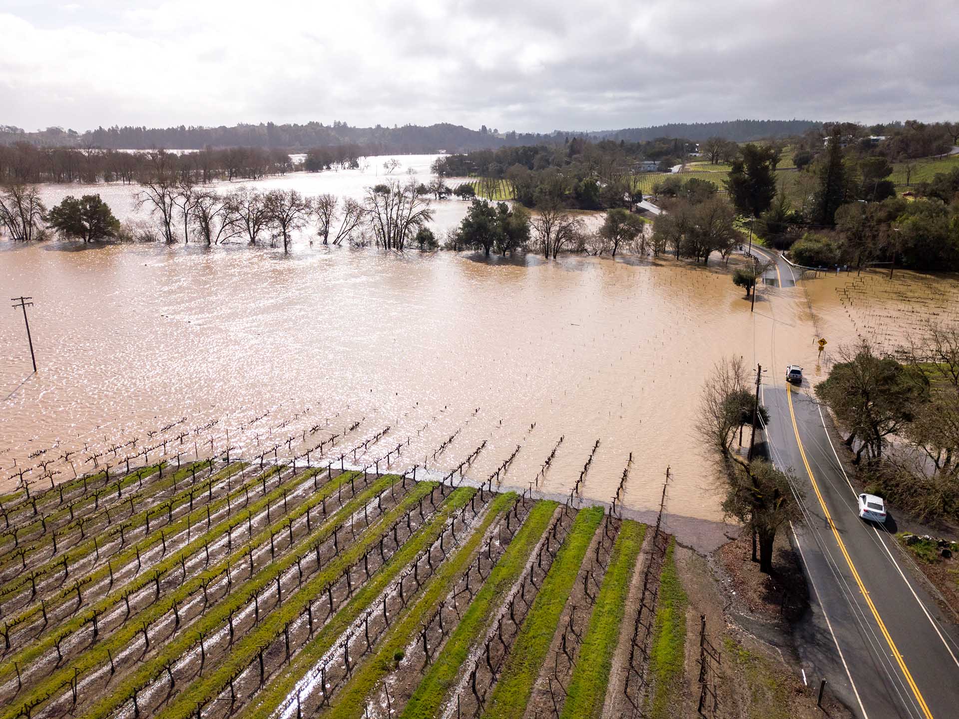 Healdsburg, CA / USA - Feb 27 2019 - Flooding beside the Russian River on Westside Road.
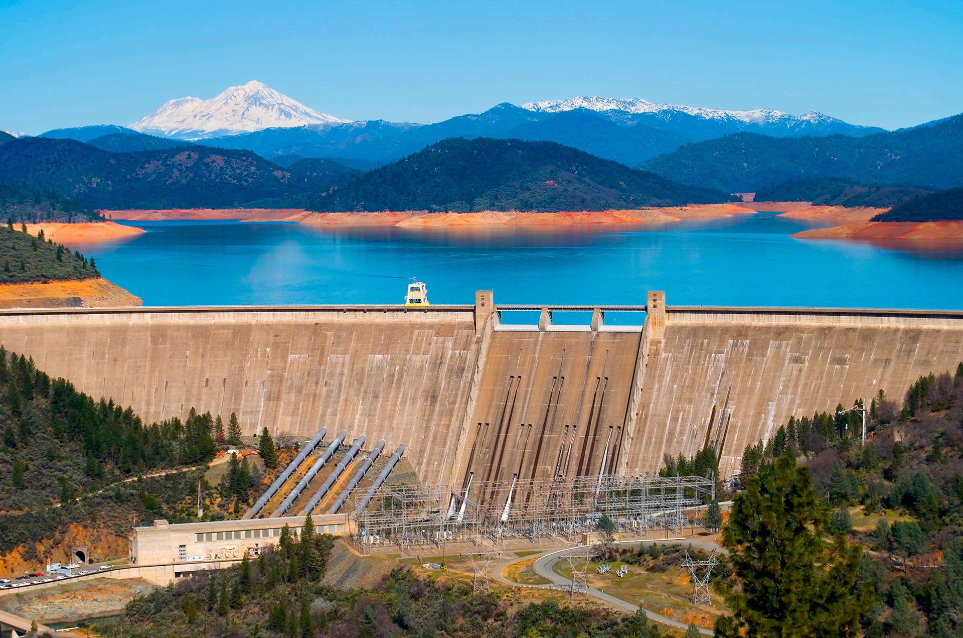 Shasta Dam
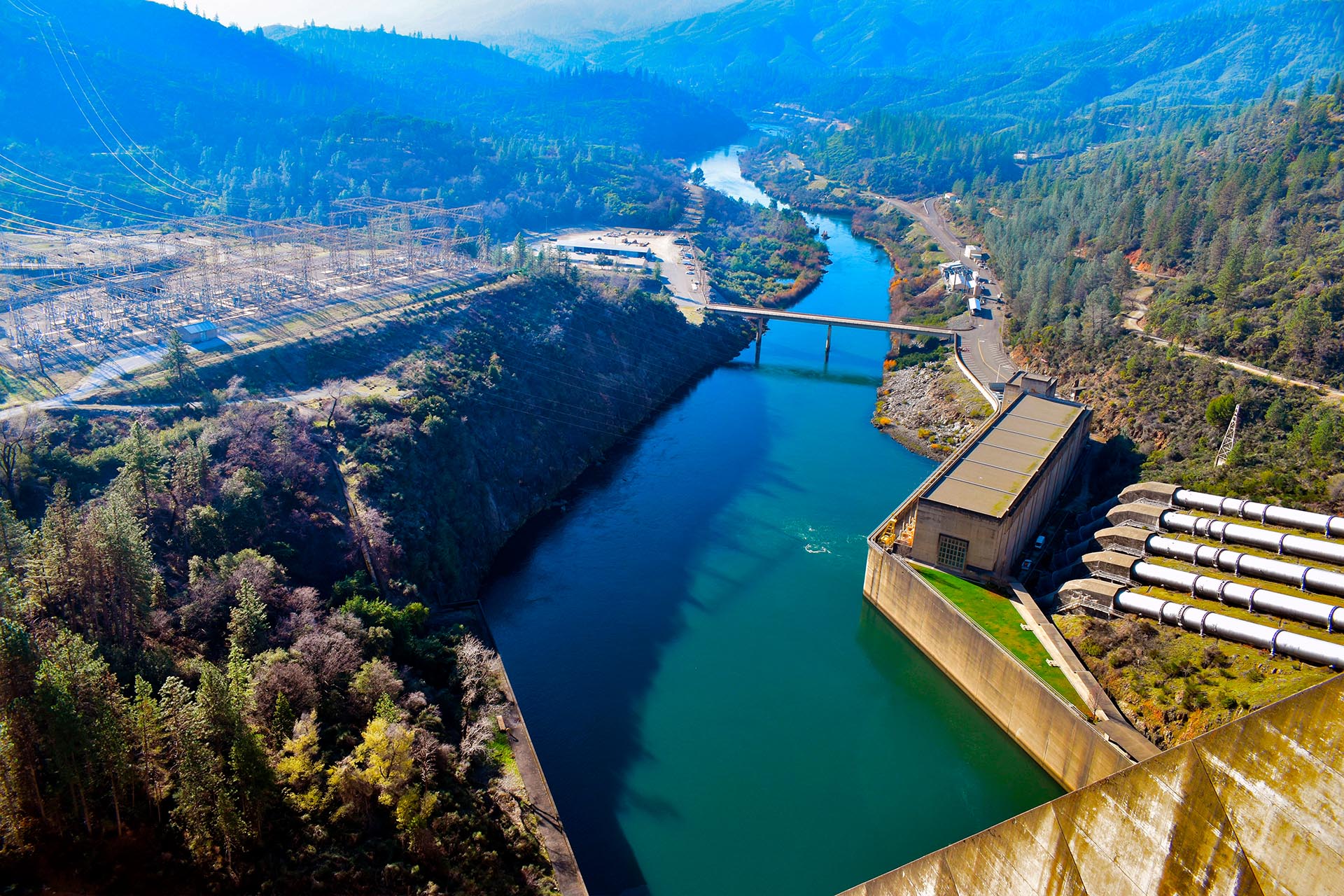 View of Shasta Dam From Overlook
 An aerial view shows the dry hills and reservoir near Pleasanton, California. Drought is affecting the entire state of California and wildfires are now common.
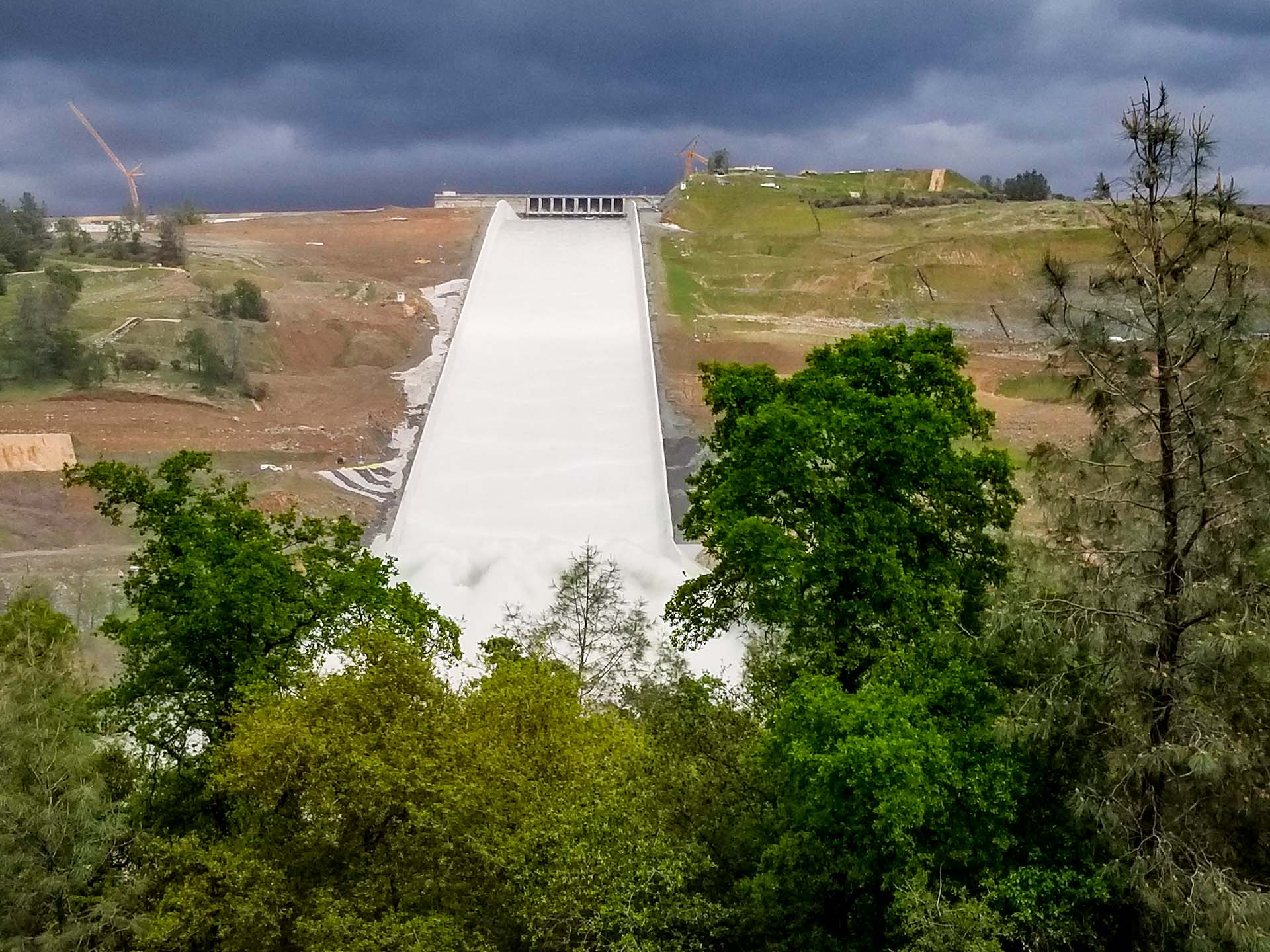 OROVILLE, CA/U.S.A. - APRIL 2, 2019: Amid continuing construction,.the Oroville Spillway re'opened today. Two years ago the town of Oroville had to be evacuated when the bottom part gave way.
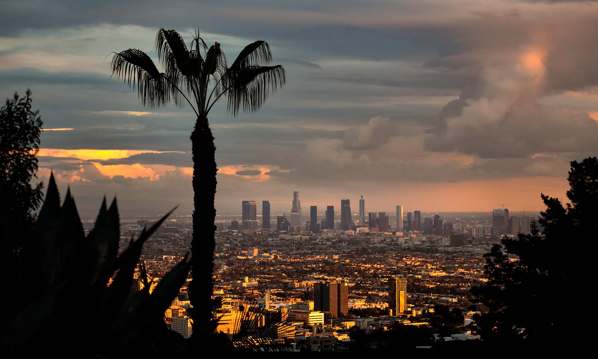 After Rain of LA View From Hollywood Hills
- California’s water infrastructure was designed decades ago, when climate change was not seen as an urgent concern
- After the recent rains, 14 reservoirs captured 31.7 billion liters of water
- California plans to spend 600 million dollars upgrading the Whittier Narrows dam
- The state’s drinking water needs over the next 20 years will require 51 billion dollars in investments.
- In Los Angeles, 28% of the city’s 6,780 main water pipes were installed before 1938
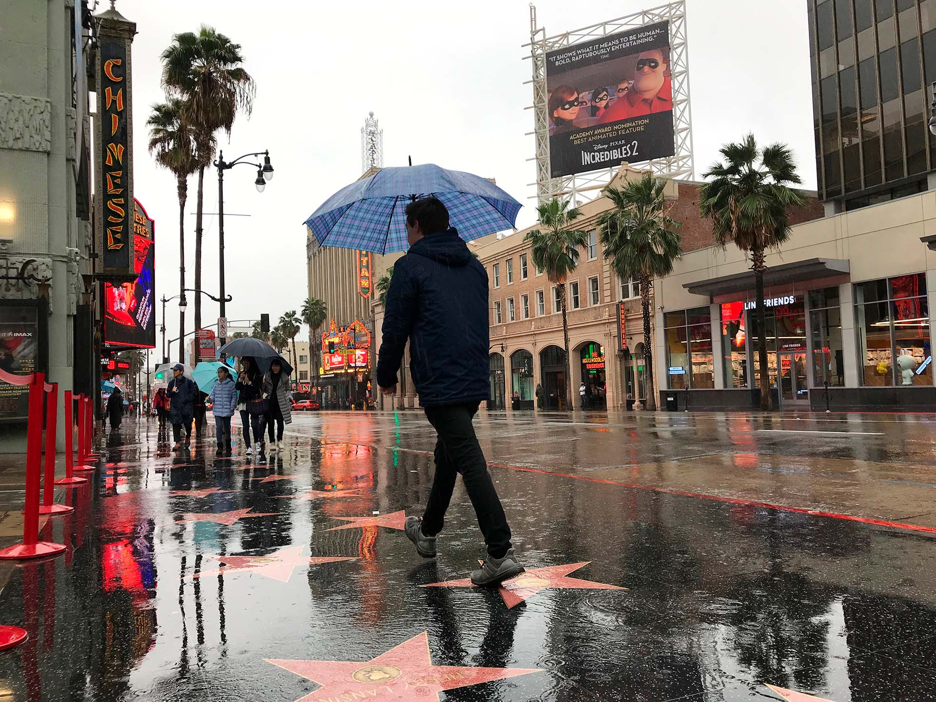
California is in a constant battle with water, alternating yearly droughts with hammering rains and floods. Since the end of December, violent storms have swollen rivers, covering homes, roads and people in mud and killing around 20 people. When the storm dies down the result, almost ironically, is the same it has been for several years now: billions of liters of water, which could be stored to face droughts, end up instead into the Pacific Ocean. The state is not remaining idle, but so far the programs it has completed or begun have not been able to capture as much water as was hoped.
The double emergency of drought and flooding characterizes California’s perennial contrast of highs and lows. «We anticipate that this may be one of the most challenging and impactful series of storms to touch down in California in the last five years,” Nancy Ward, newly appointed as California Office of Emergency Services Director in December 31 by Governor Gavin Newsom, said at the beginning of January. Several counties in the state have activated systems to hold as much water as possible to reuse it during the summer months, transforming an emergency into an opportunity.
California’s water reservoirs, an insufficient resource
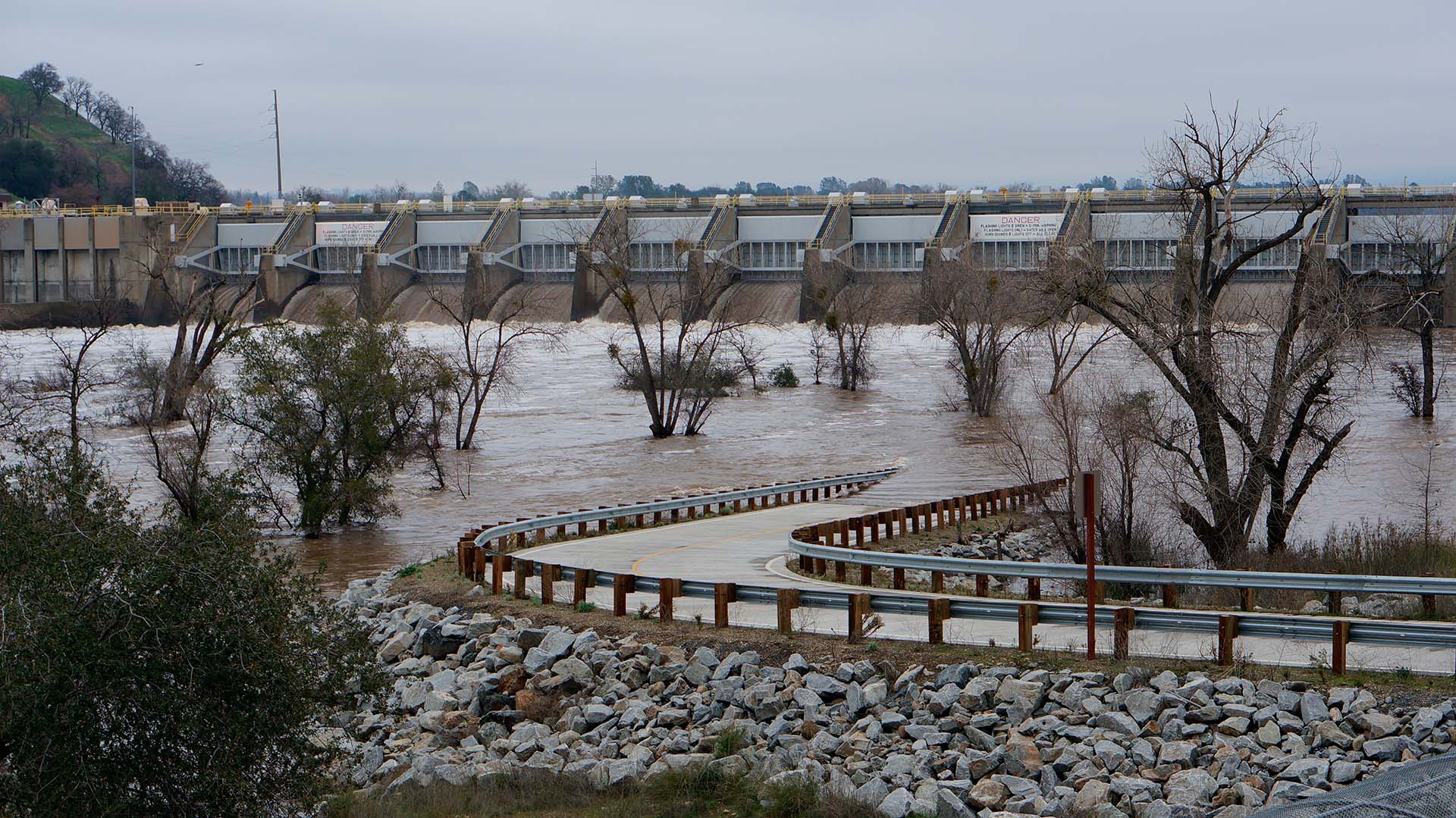
California counts on a system of 1400 water surface reservoirs built over many decades, as well as thousands of miles of banks to manage surface waters. Two dozens large reservoirs hold more than half of the total storage capacity, managing water flow during the periods of heavy rains or snow melt, to avoid flooding the communities downstream. The largest of these, the Shasta and Oroville dams, were reported by NBC News to be quite empty by the end of the year and were able to considerably reduce the impact downstream of the latest storms by capturing a large amount of water. Other smaller basins were not able to store all the inflow. The lakes of Folsom, Mendocino and Millerton had to release water downstream in a controlled manner, thus losing much of this precious resource.
California’s water infrastructure was designed decades ago, when climate change was not seen as an urgent concern and weather forecasts were less powerful. A century ago, Los Angeles built what is still widely considered the most sophisticated urban flood control system in the United States, designed to capture the water from Pacific rainstorms. The recent rains, according to local media, filled the city’s 14 dams with 31.7 billion liters of water.
“Severe weather events and increased flood risk are inevitable impacts of climate change,” Mark Pestrella, director and chief engineer of the Los Angeles County Flood Control District, told the Los Angeles Times. “The Board’s action today aligns with the county’s sustainable plan to make infrastructure improvements that reduce flood risk, increase local water supplies through stormwater capture and groundwater recharge, and improve water quality across the county.”
Among the priorities of the U.S. Army Corps of Engineers is upgrading the 65 years old Whittier Narrows dam, at a cost of 600 million dollars, the Times reported. The dam, built in the hills about 11 miles from downtown L.A, is deemed to be at the highest level of risk by the Corps of Engineers after it found three potential ways it could fail, threatening more than a million people downstream in the Pico Rivera valley and Long Beach.
The investments necessary for the state’s water equilibrium
According to the American Society of Civil Engineers (ASCE) 2019 report on California, the state’s drinking water needs over the next 20 years will require 51 billion dollars in investments. The outlay is necessary to upgrade the water mains network. In San Francisco, about 150 miles of pipes, out of a network of 1.200 miles, is more than a century old. In Los Angeles, 28% of the city’s 6,780 main water pipes were installed before 1938. According to ASCE, large urban centers generally have state of the art water treatment centers, while many rural areas depend on wells that are no longer adequate during droughts.
Last spring, state dam inspectors deemed 112 California dams as “less than satisfactory.” In contrast, ASCE reported that more than half of the 1,476 federal, state and local dams is at high risk. About 70% are more than 50 years old, and although California increased the budget of its Division of Safety of Dams (DOSD), bringing it above the national average, ASCE believes the state does not fund fully the programs necessary to guarantee an adequate safety of the dams.
California DOSD was created in 1929 after the collapse of the Saint Francis dam some 50 miles north west of Los Angeles. When the concrete arch of the dam collapsed, it caused a wave that killed 600 people. Almost a century later, in February 2017 heavy rainfall damaged Oroville dam’s main and emergency spillways, prompting the evacuation of more than 180,000 people living downstream before the situation was brought under control.
The construction of new large dams in California is today virtually impossible because of a lack of sufficient funds and new environmental laws, issued also in the wake of the Oroville dam scare. Instead, series of smaller dams and reservoirs are used to avoid flooding and the loss of water into the sea. According to ASCE, modern weather forecasting can help dam owners better predict when to release water to avoid flooding and when to stock it for local water needs. Innovations in this sector also have the potential to increase the percentage of electricity produced without impacting the environment. But without a long term view, California’s struggle with water risks remaining unresolved.